


Four men and one Tibetan Mastiff, make an incredible 8,000–km journey across the wonderful but perilous Himalayan frontier.
Editor’s Comments:
In 1981, the then Captain Harish Kohli (an Infantry Officer) serving a stint in the remote region of Arunachal Pradesh where the Brahmaputra River enters India, decided on this daring expedition with no large train of porters and sherpas. Just four young determined soldiers set out on an adventure which became a historic feat in mountaineering history. This is his account of the trials tribulations and great adventure that he undertook.
The world is well aware of China’s ambition to geographically dominate and politically influence the Asia Pacific region. Standing at the heart of this geopolitical situation are the mighty Himalaya, where China is trying to push for strategic economic corridors to reach the Indo-Gangetic plains. However, the recent Chinese construction of a road in the disputed Doklam plateau on the Bhutan–China–India border in the eastern Himalaya and Chinese incursions into Gulwan River in Ladakh in the western Himalaya, acquire a new perspective. Given the remoteness of these areas, these acts are unlikely to make an impact on global strategy but they are of crucial significance to regional policymakers, scholars and the world at large.
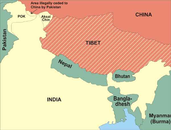
The land frontiers of India – from Arunachal in the northeast to Ladakh in the northwest – have been subject to tension and territorial disputes ever since independence. The main reasons are the controversial McMahon ‘crest line’ demarcating Tibet from northeastern India and the dispute over Aksai Chin or the ‘desert of white stones’ in the northwestern Himalaya. There are indeed large parts of the Himalaya with very difficult terrain but “these Himalayan ramparts have been breached in the past” and will be breached again. Hence, policymakers who think of the High Himalaya as the mighty ‘wall of India’ should deviate from the comfort of a false sense of an impregnable ‘maginot-line’ .
While posted in the Siang district of Arunachal Pradesh in 1980, I mooted the idea of establishing outposts upto the actual McMahon Line as a symbol of our sovereignty. However, my initial concept to travel across these passes inArunachal soon transformed into a much larger challenge: to traverse the entire length of the Himalayas, at the highest possible altitude. This became the epoch-making Trans-Himalaya Expedition.
Arunachal Pradesh
We were a small team that comprised my deputy leader HS Chauhan, NB Gurung, ND Sherpa and myself, all from the Indian Army. Starting on 15 Jan 1981, from Kepang La near Gelling, overlooking the River Siang (Yarlung-Tsangpo River, the main tributary of the Brahmaputra), we hacked our way through pristine tropical forest. The mid-winter rain was a welcome respite from the steamy heat, but there was no escape from tiger leeches, dim-dams (Simulium flies or Black Flies) and other horrid insects whose bites left itching soresand gave us excruciating pains in our leg muscles. It wasn’t uncommon either to find an over three-metre long king cobra,basking on a sunny patch of our narrow trail, blocking our way.
Our first severe test of determination and skill came while traversing the stretch from Siang to Subansiri district over the Chetak Pass (3,877m). The mountain passes of Arunachal are not high, but the approaches are covered with dense mixedforest and bamboo with such a thick canopy that you can hardly see the open sky. In such an environment, our map was almost useless. The local people rarely cross these passes in winter, and any paths that exist are made by those hunting in summer for hog deer, barking deer and spotted deer – though we also found evidence of leopard and panther. Finding these trails buried deep under three metres of soft snow in a thick, dark jungle became our worst nightmare. But when we finally reached a village, after six treacherous days, battered, tired and hungry, the villagers refused to sell their produce to us, calling us the ‘Devils from the East’.
Trekking through the pestilential forest of Subansiri district, we came across the marauding Daflas, known and feared for their raids on the Army and Indian administrative patrols that strayed into their hill territories. I remember spending a sleepless night on an earlier Army patrol to Achingmori, where an Assam Rifles column was massacred in 1953 by Tagin tribes. Some measure of that suspicion stayed with me as we made our journey through the villages of Arunachal.
All along the border, we heard stories of past trade routes to the north, of which the route leading north from Tawang, the birthplace of the sixth Dalai Lama, is the most important. Finally, on 26 March 1981, after 70-odd days of walking across Arunachal Pradesh, we crossed into Bhutan at Blettingwhich is South West of Tawang across the Nyamjung Chu. It took us a further three days to reach Tashi Yangtsi Dzong, in Lhuntsi valley, the easternmost valley in Bhutan.
Bhutan and Sikkim
The passes of Bhutan are famous, according to legend, fortreating the mule and the king alike. The saying holds true for Radong La, which leads into Bhumthang, for so steep is the gradient here that even a king must get off his mule, lest both of them fall. While camping below Naksi La, the fierce winds that lashed our tent exceeded 60 knots (110 kmph). For three hours, we laboured to save the tent, but it was torn to shreds, leaving us exposed to the forces of nature.
There is a feature of special importance in the contours of thisland – the ‘Black Mountain Range’ that runs north–south and almost divides the country climatically and ethnologically. Travelling along its western valley, one could reach the high plateau of Lunana, close to Mt Chomolhari. Even in the Himalayan summer, this could be a momentous challenge, taking almost a month and crossing over 14 high mountain passes. We did not aim to pass through Lunana – as it was offour primary route – but we found the temptation to explore it irresistible.
After a 10-day exploration in the region, making some spectacular climbs over snow–covered passes, we returned to Dhur, where we found our reward: a month-old fluffy dog, a Tibetan mastiff breed. He appeared to have no owner, so we decided to take him along with us. We named him Druk, meaning ‘dragon’, and he became our mascot. In April, the clear skies and warming sun inspired us to cover long distances, making between 40 and 50 kms a day. Druk, of course, wasn’t expected to keep up such a pace, so we carried him on our already heavy rucksacks weighing over 40kg. Nevertheless, Druk was a source of solace and good tidings.
Crossing over to Sikkim at Doka La, we climbed up via Yuksom to HMI Base Camp, which offered a panoramic view of the high mountains of Sikkim. Glowing in the evening sun, Mt Kabru Dome (6,600m) fascinated me. Chauhan was suffering from high-altitude sickness, so, while he rested, the rest of the team decided explore its southern approaches.
After establishing an advance base camp south of Mt KabruDome at 5,800m, we set out to explore the glaciers at its base. We approached the mountain from the east, west and south but the glaciers were fissured with crevasses and ice walls, making it difficult for us to reach high up the mountain. After three weeks of reconnaissance of the entire south side of Kabru Dome, we concluded that the only successful approach was from a saddle between Mt Kabru and its Dome, from where a route for the final ascent could be found. Alternatively, one could make a rock-climbing ascent, with the right equipment, up its southern face, which we attempted,reaching a point we estimated to be 200m below the top.
Nepal
It was now mid-June, when the monsoon first reaches the Himalaya in far eastern India and Nepal. We were crossing the Rathong La (5,547m) on the northwestern ridge of Mt Kanchenjunga, into Nepal. Just below the pass, it began to snow so we rested against a large rock to put on our jackets. Suddenly, we realised there were five of us. Druk had discovered a fifth person, who was wrapped in a shawl – not a breathing human being but a ‘dead man sitting’. Earlier that morning, the caretaker of HMI Base Camp at Chaurikhangtold us about a man who had come to his camp earlier thatyear. “He was alone”, he said, “he wasn’t a mountaineer really, nor did he appear to be equipped for a trek.” The caretaker offered him a cup of tea and asked why he had come, to which he merely replied, “To die”.
Crossing the Rathong La, we moved down the west Rathongglacier, where a herd of mountain goats scampered in all directions on seeing us. As the clouds parted, we could see Mt Jannu (7710m) and Kumbhakarna (7709m) to the northwest,while, to the east, standing like a giant wall, was Kokthang(6148m). It was a glorious beginning to what would be our five-month trek through Nepal. The monsoon had arrived but we managed to make some spectacular climbs and trek past the base camps of some of the highest peaks in the world.
Following the Barun River, we established our camp on the Barun glacier at the base of Mt. Makalu (8485m), the fifth highest mountain in the world. As the sun was about to set, we saw two figures descending from the mountain. They were poorly clothed and their feet were almost black though fortunately not frostbitten. They told us about their climb (without equipment) to Camp IV to retrieve ropes and thingsleft behind by foreign climbing teams that they would sell to other expeditions. Listening to their story, we realised how some mountaineers can afford to climb for glory, while others risk death just to survive.
Moving on towards Mt Everest in the Khumbu region, our expedition faced the colossal challenge of crossing the Sherpani Col (6150m), West Col (6143m) and Amphu LabtsaPass (5800m), the three highest passes in the Himalaya. Except for some British mountaineers, no one had then crossed these passes. Even today, the trek between Makalu base camp and Sherpani Col is one of the longest and most strenuous of all treks in the Himalaya, requiring extensive preparation.
Of these passes, Amphu Labtsa, with a 600-metre vertical wall, was prone to rock–falls. We managed to safely descend the pass but, just as we reached the base, a large boulder came hurtling down the slope straight in our direction. Although we dived for cover, the boulder hit my rucksack and flung its contents – film rolls, camera and the expedition’s cash –all over the glacier. Undeterred, we moved on to Chukung in the Everest region and, two days later, climbed the nearby Island Peak (6189m).
After a round trip to Everest base camp, we headed to Gokyovalley and via the Sherpa villages of Pangboche and Namche Bazaar entered Rowling Valley over the Tashi Lapcha pass (5755m), from where we climbed Pachermo peak (6273m).We were now traversing just south of Mt Gauri Shankar (7134m) on the Nepal–Tibet border until we reached the Araniko Highway. Here, we took a short break in Kathmandu to replenish our equipment and funds, and had a surprise visit from Reinhold Messner, the legendary mountaineer. It felt good to hear him say that, “What I do vertically, you do horizontally.” That literally summed up our efforts and ambitions.
Soon, we were back on our trail, walking through Nepal’s remote interior via tribal settlements, where people were slovenly and inhospitable. Druk had by now grown into a great mastiff, standing at least 60 cm tall at the shoulder and weighing 50 kg. He looked handsome in his shiny black coat and, with his lion’s growl, was the envy of local mongrels.But meeting new people along the way had made him mild–mannered and friendly, which almost led to his downfall. For it was at Gatling that Druk was abducted. Luckily, he managed to escape and travelled over 40 km that night to join us at our next camp.
Following the Marsyangdi (Marshyangdi is a mountain river in Nepal. Its length is about 150 kilometres), we reached Manang, from where we crossed over Throng La (5416m) to Jomsom. Passing through Kali Gandaki, which separates the major peaks of Dhaulagiri (8,167m) on the west and Annapurna (8,091m) on the east, we made our way down the deepest gorge in the world before reaching Rara Lake, the most wondrous lake in the Nepal Himalaya. The last stretch of western Nepal had been difficult, and, with depleting funds,we were sometimes forced to cook stinging nettles for food. But the view of Rara Lake under a full moon revived our energies and we pushed ourselves to enter India over the Darchula bridge in then Uttar Pradesh now Uttrakhand.
Western Himalaya
Back on home soil, we quickly replenished our food supplies and passed along Gori Ganga to Milam in Johar valley, home of the legendary travellers Nain Singh and Krishen Singh Rawat. Somehow, we managed to cross over Unta Dhura Pass (5364m), which has an evil reputation for blizzards, and the adjoining Kinger Dhura Pass, before making our way via Lapthal (on the site of the ancient Tethys sea) to Malari and over the Mana Pass (5632m) to Harsil and thence enteredHimachal Pradesh.
At the end of Himachal Pradesh, the Himalaya fans out to encompass the valleys of Jhelum, Indus, Nubra and Shyok. Those who have been to these regions will confirm the difficulty of the terrain between Spiti and the treacherous Karakoram Pass. To enter such forbidding terrain when we were already tired and debilitated was even more laborious and hazardous.
Chow (Chouhan) had begun to crack under the growing effects of high altitude, fatigue and psychological pressures. NB (Gurung) and ND(Sherpa) were no better. Hunger had weakened us physically but the journey seemed to be taking its toll on our minds. After crossing Parang-La and traversing the Chang Thang region of Ladakh, we reached Depsang La – the ‘roof of the world’ – a wide plateau above 5,151 metres. Ahead was the vast Karakoram wilderness, with an old caravan staging post still known by its Yarkandi name of Daulat Beg Oldi (4,848m).
Next day, we scrambled up a craggy spur in the north on to a saddle marked by a simple stone cairn. Here we unfolded our tri-colour and shook hands solemnly to mark our achievement. On that day, 5 May 1982, at the Karakoram Pass, unknown to us, history was made.
We became the first small group to successfully traverse the length of the Himalaya from Kepang La (near Gelling) south of Namche Barwa in the east in Arunachal Pradesh, to the Karakoram Pass, near K2 in the north-west in North Eastern Ladakh. We had traversed almost 8,000 kms, through the darkest jungles of Arunachal and Bhutan; and alongwithDruk, across the foothills of Kanchenjunga in Sikkim; along the highest mountains of Nepal and Uttarkhand; over the high plateau of Ladakh and across the treacherous passes of the Karakoram. In our long journey of 475 days we had crossed over 50 Himalayan passes, explored new routes, climbed two mountains and attempted Kabru Dome from its virgin south face.
Our achievement astonished the mountaineering fraternity. Explorers from around the world followed (albeit from Bhutan or Sikkim), including Peter Hillary, son of the legendary Everester, Edmund Hillary. But our carefully selected route in the high-Himalaya was no match for the latecomers. Sorrel Wilby, who followed us from Bhutan andtook a lower route, said in her book Across the Top, “A four-member team representing the Indian Army had managed to march all the way from Gelling, on the Indo/Tibet border, through to the Karakoram Pass… to my mind, the Indian effort was – and still is – the best in Himalayan history.”
Addendum : Some Lessons
The Trans-Himalaya Expedition 81-82, managed to traverse across the length of the Himalaya, from Gelling in Arunachal Pradesh near Namche Barwa, at the northeast end of the Himalaya to Karakoram Pass in Ladakh near Mt K2 in the northwest. The fact that four-members, without high-end equipment and clothing at the time, could explore a high-route over 50 high-altitude passes, sometimes in the thick of winter, was indeed an outstanding achievement. It caught the world’s attention as “this traverse became a symbol of the unconquerable spirit of man and a sage of sustained endurance and fortitude.” An important aspect of the expedition is that even today, it inspires us – policymakers, strategists and regional commanders – to draw lessons from their incredible adventures. Here are a few that should be considered.
Winter Exploration: The expedition spent two winters during their adventure. In the first winter (15 Jan – 25 Mar 1981), the expedition managed to cross over half dozen thickly forested and snow covered passes of Arunachal. While in the second winter of 1981-82, the expedition crossed the high passes of Western Himalaya. Although the local commanders imposed many restrictions on their movement, (because of their safety concern) the team proved that anyone with the right experience, equipment and determination can operate successfully during winters in the high-Himalaya.
Establishing Outposts: The Trans-Himalaya Expedition has shown that it is possible to reach any of the passes along the Sino-Indian border, both in summer and in winter. The expedition exposes that the border outposts require further strengthening and the need to establish posts on the border, (using the latest GPS technology) to indicate the ‘Line of Control’ (LOC) or the actual border as a symbol of our sovereignty, which should be regularly patrolled in all seasons. This is particularly true in Arunachal Pradesh where the McMahon Line marks the border, the high-altitude plateau of Chang Tang and the desolate Karakoram mountains.
Trans-Himalaya Route: The research for preparation of the route, according to the leader, Harish Kohli, was developed after reading historical records of explorers who had crossed high-mountain passes in the past and then stitching it all together to form one large route across the Himalaya. This was a mammoth task as some grey areas remained, but greatly helped by the availability of vintage books in our libraries in the Army. This gave the insight about weather and terrain which the leader incorporated into his plan. Hence, for any future expedition or Recce planning, it is recommended to first explore your unit libraries and read records of past adventurers who may have followed your expected route.
Challenging the Weather: The extremes of weather, is always considered as a deterrent, which is true but it should be considered, as just one of the many challenges of an expedition. Each challenge should be first considered individually and a strategy developed to counter it before considering it along with other challenges you will meet on your expedition. A careful study of equipment and clothing should be made based on detail research and then a list prepared. Each item of equipment and clothing should be weighed against its usability because at the end of the day, you have to carry it. As Harish says, “we always think that good equipment and clothing is the solution to bad weather but the fact is that cold is just the state of mind”.
 Please wait...

Congratulations for such a courageous trek. And, it was a wonderful read, here.
However, it would have been even more enjoyable had there were references to (late) Bidyut Sarkar, an unsung mountaineer from Kolkata, West Bengal, who for the very first time (literally) ventured out into a ‘solo trans-Himalayan trekking expedition’ in 1976.
From Ladakh to Arunachal Pradesh, this solo journey was, has been and would be an epic pioneering feat, which inspires a large section of amateur mountaineers even now.
A big salute and kudos to you and your team sir ?. Very inspiring article. Very lucidly written. I felt like I was there on the expedition.
Hi all.. Thank you for your comments @JP and ‘@Nayyar… Yes I do remember you all and good to connect again. Will upload pics soon. Greetings and thank you for your support. Regards
Lt Col Kohli Sir
loved the art. If u have pics can upload on my site http://www.esamskriti.com, a pic speaks a 1000 words. credits to u.
Great Sir. I knew you to be hell of a guy. Met you in HAWs . I was doing Basic WW, while you were doing the adv course. Wonder if you remember me JP Singh….Paras. the guy was who was mostly on the wrong side of the law.one hell of a time we had there.
“Cold weather is the state of mind”, yes. Our defensive outposts should make this cold weather their normal habitat. In fact, what India is lacking is the participation of every able-bodied Indian to serve in army and contribute one’s part in defending our mother land as sacred duty.
Harish has lucidly recounted his trek expedition which today has immense value considering current geopolitical situation unfolding in LAC. I guess military planners would draw appropriate conclusions and take aways from this article.