


IDR Blog
Lt Col Stobdan Kalon, VSM: The man who reconnoitered Siachen in 1978
 Please wait...
The exploits of Col. ‘Bull’ Kumar in India’s Siachen saga are well documented. It was from his chance meeting with Volkar Stallbohm and Jaroslav Poncar in 1978 that Kumar learnt about Pakistan permitting expeditions in the Siachen region. His interest in the region having been triggered, Kumar gathered more details about the expeditions and the maps in use before concluding that by sponsoring mountaineering expeditions in a region which was un-demarcated Pakistan was trying to establish a de facto claim on it. This made him convince the then Director Military Operations Major General M L Chibber to seek the Army Chief’s approval for an Indian exploratory mission in the region. As expected, the permission was accorded and the stage was set for Kumar’s 1978 expedition to Teram Kangri and Siachen.
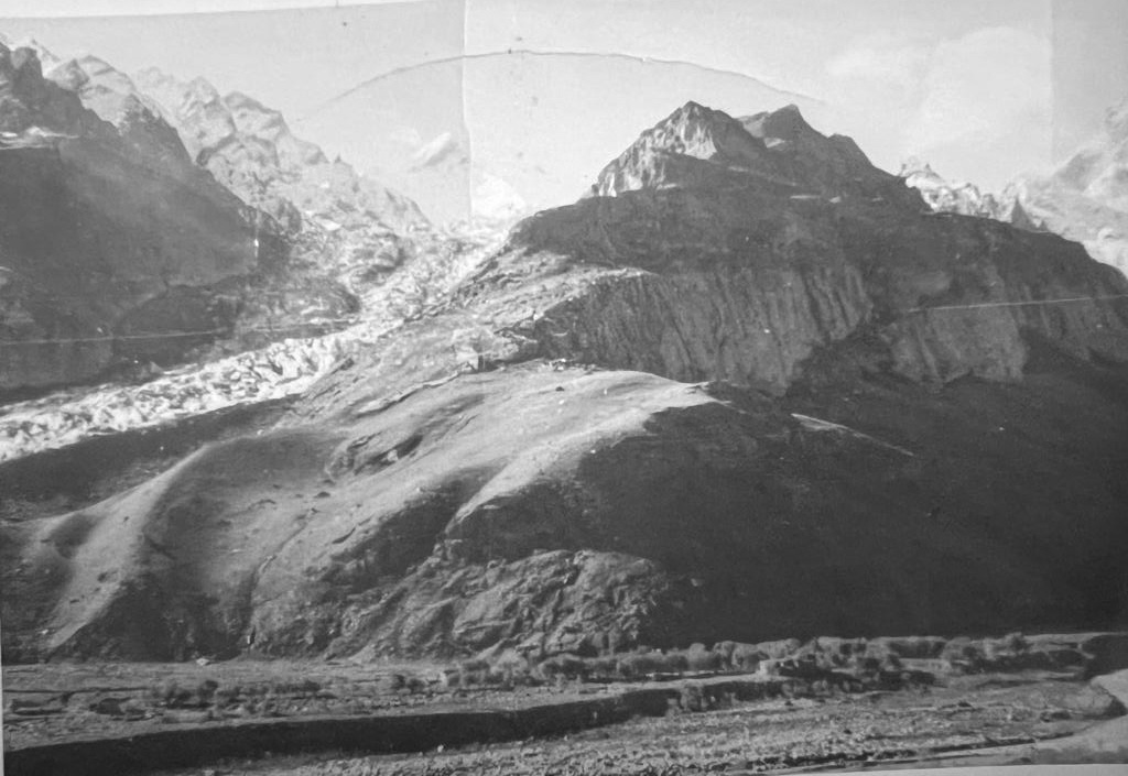
 Even though the Geological Survey of India had conducted a snout survey of the Siachen Glacier as early as 1958, the information available about this region especially from a mountaineers perspective was very sketchy.
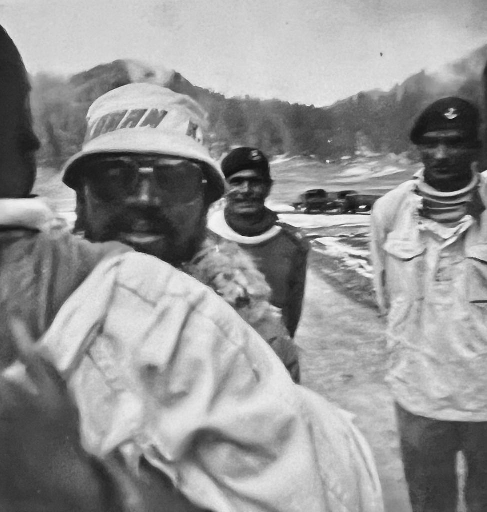
Therefore it was necessary to send an advance party for a general recce of the entire region to identify the possible access routes and assess the logistical requirements so that the main expedition could be planned and successfully mounted. The responsibility of leading this reconnaissance mission to Siachen fell on Major Tsering Stobdan Kalon, an instructor at the High Altitude Warfare School (HAWS).
Born in Leh on 24th July 1942, Kalon was commissioned as a Second Lieutenant in 12 Jammu and Kashmir Rifles from IMA Dehradun in 1966. In 1978 he was posted at HAWS as an Instructor and was running its advanced mountaineering and skiing course.
 Kalon, 81, recalls that though he had heard the name Siachen before as it was one of the longest glaciers outside the Poles, he was not familiar with the region at all till he was assigned this top secret mission by Kumar.
‘The objectives of our mission were (a) to find out details/evidence of any explorations from the Pakistani side (b) to see if any track or route was being built or used by the Chinese to access this region (c) to map the possible route for the full expedition which was to be inducted subsequently (d) to ascertain how many people and what equipment would be needed for the expedition and (e) identify the possible logistical challenges and address them’.
Kalon’s recce team had four other instructors from HAWS and they set out on their mission in the summer of 1978 with porters, ponies and camels for support. They travelled to Sasoma by vehicle and thereafter the journey was on foot. Their first stop was Changlung followed by Tongstead and Warshi before they reached the snout of the glacier. ‘We had only blank maps and were required to mark all the landmarks, routes, proposed camp locations and other important features for the expedition. We spent around two weeks in and around the glacier to gather all the information. On our return I gave a sand model briefing to the Commandant and also presented the terrain assessment, route mapping and logistical support estimate for the expedition which was being planned before the onset of winter in the same year’.
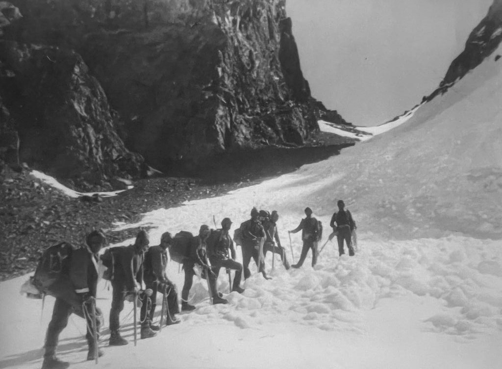
 Thereafter Kalon was appointed as the Deputy Leader of Kumar’s Teram Kangri Expedition Team of 1978 and led from the front. The team set out in September 1978 and the main party reached Khalsar on the 2nd. Kalon’s ancestral home at Tegar served as a virtual transit camp for the expedition team and since his family owned the only double humped Bactrian camels in the region at that time it was decided to use their services as well during the journey.
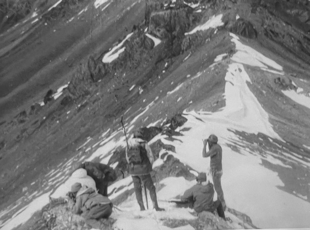
Based on the inputs of the recce mission Camp-I was established at the base of the summit after crossing the Teram Shehr glacier, at an altitude of around 19,000 feet. Kalon was then tasked with opening up the route to the summit from the glacier and marking it out with ropes so that the others could follow. The route to Camp II was over a steep ridge and also went under loosely hanging ice masses which could give way anytime.
However Kalon’s team successfully navigated the path and established the Camp at 21,000 feet. ‘The stay at this camp was very risky as there was a constant threat of falling stones and avalanches. While the food consisted of ‘khichdi’ which we cooked by melting the ice the biggest problem was the toilet as we had to precariously balance our self with ropes while watching for falling stones and had less than a minute before freezing’, recalls Kalon.
 On 6th October 1978 the route to Camp III established at an altitude of 23,000 feet was opened. Finally on 13th October 1978, the 24,300 feet Teram Kangri –II Peak on the main crest of the Karakoram Range was summited by the Indian Army mountaineers who stood overlooking the Shaksgam Valley. ‘‘This entire expedition lasted almost three months. Almost every day Pakistani fighter planes would fly close to us trying to observe our movements and intimidate us. We also found several cigarette packets, cans and some leftover gear from previous expeditions to the region which were later sent to the HQ for analysis”, remembers Kalon.
While Kumar’s well publicized Siachen Glacier/Teram Kangri expedition of September 1978 set the stage for all future Indian expeditions to the region and provided vital strategic inputs for the Army, it would not be wrong to say that the foundations of its success were laid in the summer of 1978 when Kumar first tasked Tsering Stobdan Kalon to undertake a preliminary recce of the glacier snout.
Please wait...
